Healing Places
The list below contains healing places submitted by our community members. Please take a moment to share your favorite healing place in either Marin or Sonoma County with us by using the form, below. We'll post all the great healing places on this page!
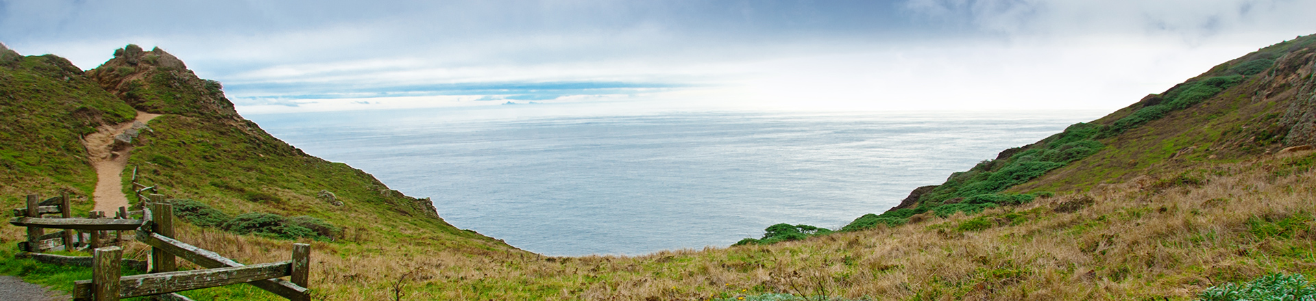
Alamere Falls
Alamere Falls is a waterfall in Point Reyes National Seashore, Marin County, California. Alamere Falls is a rare "tidefall", a waterfall that flows directly into the ocean. It is one of only two in the area, the other being McWay Falls. Alamere Falls can be reached by following the Coast Trail from the Palomarin Trailhead.
Aramburu Island
Aramburu Island is located in Richardson Bay, a short boat ride from the Audubon center in Tiburon. The 17-acre island was created in the early 1960's by dredge spoils and fill from nearby construction. The Aramburu shoreline was planned with a focus on creating habitat for terns and other water birds.
Armstrong Redwoods State Natural Reserve
Armstrong Redwoods preserves stately and magnificent Sequoia sempervirens, commonly known as the coast redwood. The grove offers solace from the hustle and bustle of daily life, offering the onlooker great inspiration and a place for quiet reflection.
Arturo Saldana Training
Arturo Saldana Training is tucked in the Coastal Mountains of Northern California. The ranch features 10 acres including a 100 X 250 outdoor arena and two round pens (one indoors) and multiple stalls (including an outside run and multiple outside paddocks and pastures). Arturo has worked with horses for over 25 years and offers a wide range of recreational riding. Group trail rides and beach trips are commonplace at the ranch.

Big Trees Camp - Kent Lake
Unlike the other lakes in the area, Kent Lake has almost no hiking trails around it. By automobile, major access points to the area include parking to the southeast off the Bolinas Fairfax road, or from the northwest, with seasonal parking off Sir Francis Drake Blvd or in one of the pullouts along the road.
Blackie's Pasture
Blackie was a cavalry horse in his youth, having been stabled at the Presidio. In spring the cavalry would saddle up their horses, ride to Yosemite National Park. After being retired from the Army, Blackie became a cutting horse at rodeos, and when he was 12 years old was retired to a private pasture at the corner of Tiburon Boulevard and Trestle Glen Road - Blackie’s Pasture.
Bodega Bay
Bodega Bay is a shallow, rocky inlet of the Pacific Ocean on the coast of northern California in the United States. It is approximately 5 miles across and is located approximately 40 miles northwest of San Francisco and 20 miles west of Santa Rosa.

Bolinas Ridge Trail
From the top of Bolinas Ridge take in bird’s-eye views up and down the San Andreas Rift Zone. The fault divides Olema Valley, a lovely, undulating landscape reminiscent of England, that dips slowly down to the waters of Tomales Bay in the north, and Bolinas Lagoon in the south.
Cascade Canyon
This lush preserve, tucked into the hills above Fairfax, is one of the true gems of the Open Space District. Cascade Canyon incorporates 498 acres of some of the most pristine habitat in the Corte Madera Creek watershed. Cascade Falls, at the head of the main canyon, is a popular destination in winter and spring.
Cataract Falls
Within the rolling ridges of Mount Tamalpais, Cataract Creek cascades over rock and fallen logs for the better part of a half-mile, creating waterfalls big and small as it descends into Alpine Lake. This spectacle, commonly called Cataract Falls, draws many people to the Cataract Trail, just off Fairfax-Bolinas Road.
China Camp
The park is nestled along the shore of the San Pablo Bay. The road through the park offers beautiful views of the waterfront. Features include an extensive intertidal salt marsh, meadow, and oak habitats. There is a variety of wildlife, including deer, squirrels, coyote, fox, bats, and numerous birds.
Corte Madera Ridge
The Corte Madera Ridge Trail leads to the highpoint on the ridge between Corte Madera and Mill Valley in the Blithedale Summit Open Space Preserve. This preserve is the largest link (899 acres) in a chain of preserves that follow the “Northridge” of Mount Tamalpais as it sweeps down between the communities of Mill Valley and Corte Madera. The trails and roads in this area pass through a variety of habitats, including deep forests and dense chaparral.
Creekside Park
Visitors to Hal Brown Park (Creekside Park) will find a large, expansive turf area for informal play and relaxation, a remodeled bathroom, several new benches and picnic tables scattered throughout, an area for petanque, a health and wellness grove landscaped with plants that have healing and medicinal attributes and more!
Dillon Beach
Dillon Beach is set in a serene rural setting, anchored at the Pacific mouth of Tomales Bay and overlooking scenic Point Reyes Peninsula - Complete with picturesque dunes, numerous tide pools, abundant wildlife, enticing surf and a variety of options for hikers and boaters alike.
Four Lakes Mountain Bike Loop
The Four Lakes Mountain Bike Loop is a great go-to ride for intermediate to experienced mountain bikers. The ease of access makes biking to this loop a breeze from nearby towns such as Ross or Fairfax. The ride itself has a challenging climb early followed by scenic coasting through the wonderful mountain air up in lake country.
Lake Bon Tempe
The trail head at Lake Bon Tempe offers a variety of hikes for beginners and experienced trekkers. The two mile loop around Bon Tempe Lake offers excellent photo opportunities for capturing shots of various forms of wildlife, from groves of plants and trees, to deer, birds and even a glimpse of the occasional wild cat.
Lake Lagunitas
The 1.5-mile hiking trail around Lake Lagunitas in Marin might just be the most perfect one-hour hike in the Bay Area. It’s mostly flat, so nearly everyone can do it. It’s beautiful, so nearly everyone will appreciate it. Lake Lagunitas is the smallest lake in a series of five lakes found on the north side of Mount Tam.
Larkspur-Corte Madera Creek Trail
The multi-use Larkspur-Corte Madera Creek pathway runs north alongside the tidal marshlands created by the San Francisco Bay. The pathway features: A fitness course, multiple parks for families and even a couple of close-by restaurants. Ample wildlife photographing and viewing opportunities are available.
Marin Headlands
The Marin Headlands area covers various types of histories from the Miwok Indians to the Military, including Fort Barry and Fort Cronkhite, the NIKE Missile site and the 150 year-old Point Bonita lighthouse. Other attractions include varied hiking trails, dog friendly Rodeo Beach, and astonishing views.
Mt. Burdell
I love going there for a perfect 1 hour hike, door to door. I enter off of Simmons and it's a quick warmer upper from the start. Then you meander around the backside of Olompali, with beautiful views of the wetlands and rolling hills. You can almost feel the long ago inhabitants, the Indians that were here first. I love the serene quality of a trail that is never too busy. It's a place I can skip to my own beat.
Mt. Tamalpais
Mt. Tamalpais features redwood groves and oak woodlands with a spectacular view from the 2,571-foot peak. On a clear day, visitors can see the Farallon Islands, the Marin County hills, San Francisco, the East Bay and Mount Diablo. On occasion, the Sierra Nevada's snow-covered mountains can be seen.
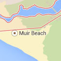
Muir Beach
Muir Beach is a quiet cove, beach and lagoon favored by locals. Muir Beach is home to numerous shorebirds, amphibians, salmon and trout, and marshy, water-loving plants . This expansive network of wetlands, lagoon, and dunes is home to the endangered coho salmon and threatened California red-legged frog.
Muir Woods
I think it speaks for itself. Great for walking, meditation or a nice quiet lunch with nature.

Olompali State Park
Olompali State Park overlooks the Petaluma River and San Pablo Bay from the east-facing slopes of 1,558 foot Mount Burdell. The Coast Miwok Tribes inhabited at least one site within the area of the present-day park continuously from as early as 6,000 BC, until the early 1850's.
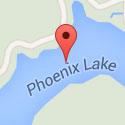
Phoenix Lake
Phoenix Lake provides convenient access and an abundance of hike possibilities. In the winter, the water rushing down from the spillway, and then in the creek, is a torrential accompaniment. Look downslope to the left for a quaint stone shelter with moss and ferns growing on the roof, it's straight out of a fairy tale.
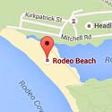
Rodeo Beach
Rodeo Beach is a beach in the Golden Gate National Recreation Area located in Marin County, California, two miles north of the Golden Gate Bridge. Rodeo Beach is known for its dark, pebbly sand, its uses for surfing and sunbathing, and its locale as a place for collecting semi-precious stones.
Samuel P. Taylor State Park
Samuel P. Taylor State Park has wooded countryside in the steep rolling hills of Marin County north of San Francisco. The park features a unique contrast of coast redwood groves and open grassland. The park features a variety of flowers and trees, including oak, tanoak, madrone, live oak, laurel and Douglas fir.

San Rafael YMCA
The Marin YMCA is a health facility with programs and classes to meet the needs of every interest and ability. With early-morning hours and late-evening hours most nights, you can start or end your day at the YMCA. Various classes, programs and services are offered to both children and adults through the YMCA.
Sky Camp at Pt. Reyes National Seashore
Sky Camp is located on the western side of Mt. Wittenberg at an elevation of 310 meters. In clear weather, it has a sweeping view of Point Reyes, Drakes Bay, and the Pacific Ocean. The easiest and shortest approach is a 1.4 mile moderate uphill hike or bicycle ride from the Sky Trailhead on Limantour Road.
Stinson Beach
Stinson Beach is a popular day trip for people in the San Francisco Bay Area and for people visiting northern California. Although most visitors arrive by private car, Stinson Beach is linked to Marin City by a daily bus service, and the network of hiking trails around Mount Tamalpais also reaches the town.
Tennessee Valley
Tennessee Valley is an amazing offshoot of the Marin Headlands, with hiking trails that suit the whole family. The Tennessee Valley Trail begins at the parking area and leads to Tennessee Beach. For the more adventurous hiker, there are a number of other trails leading into the hills above Tennessee Valley.
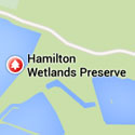
Wetlands Project - Hamilton Air Force Base
Following closure of the Hamilton Army Airbase in 1994 and development of a Reuse Plan by the City of Novato for much of the former military base, the Wetlands Conservancy assumed the lead in developing a wetland restoration plan for the former Hamilton Army Airfield and adjacent properties.